The remonumentation project in Lake of the Woods County had been years in the making, long before the first shovel hit the ground. When Chad Conner, Widseth Surveyor and project manager, was the President of the Minnesota Society of Professional Surveyors (MSPS), the organization lobbied the Minnesota State Legislature in hopes to secure funding for long‑overdue remonumentation surveying work. Survey monuments are essential markers that define land boundaries across Minnesota; they are sometimes hidden or buried through various circumstances, making them difficult to locate without the methodological process of remonumentation. In 2022, the efforts of MSPS paid off; the legislature awarded nearly $10 million to the surveying community. This investment would ripple across several counties, including Polk and Lake of the Woods, where Widseth served as the county surveyor.
Widseth’s surveying team worked to restore section corners, the physical survey markers that define the boundaries of one-mile-square parcels of land, for both Polk and Lake of the Woods Counties. We completed work on 156 corners in Lake of the Woods County alone. Widseth’s Crookston office, headed by Garrett Borowicz, handled close to one hundred more, along with additional tasks that came with the rugged terrain.
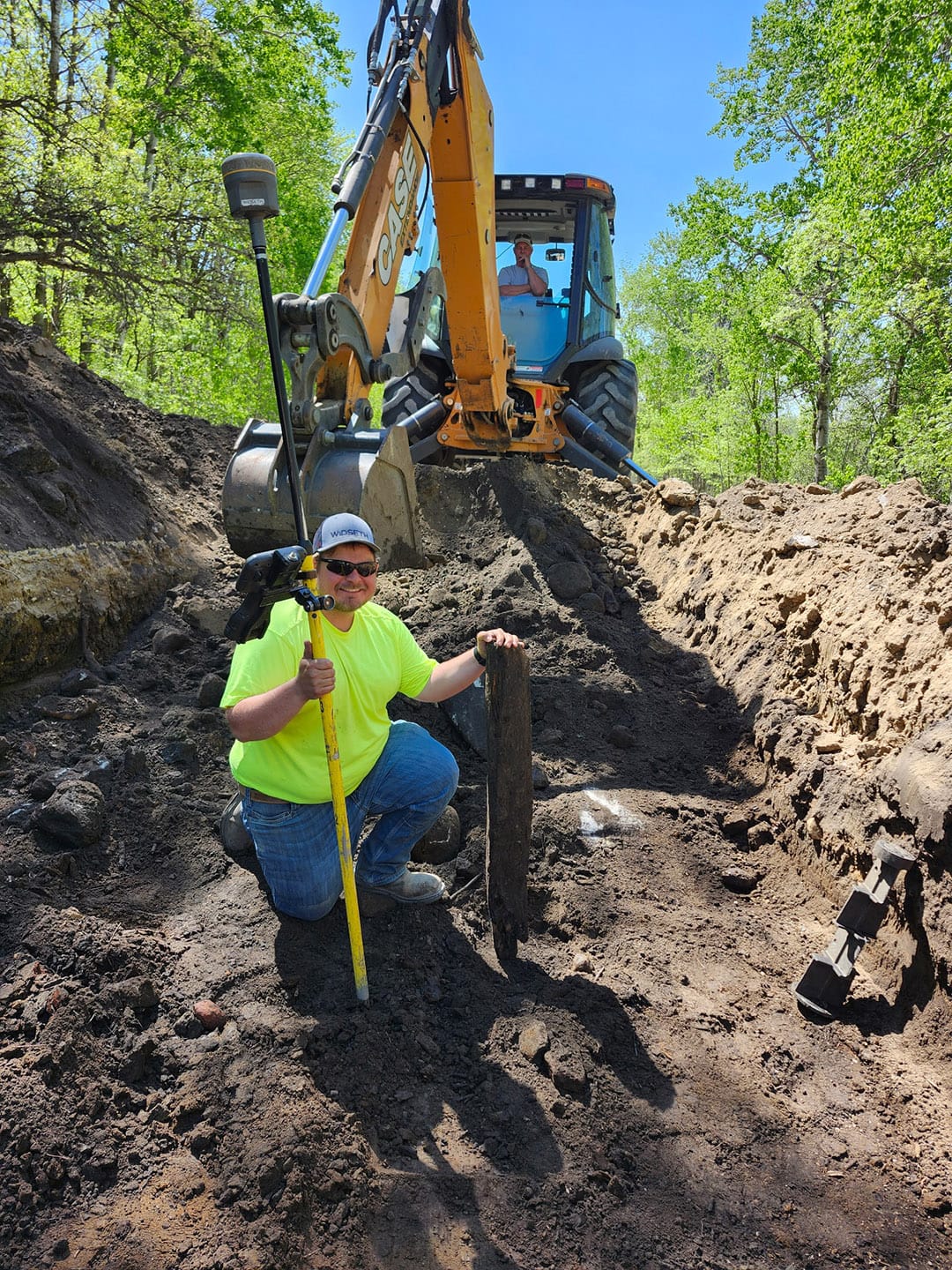
Widseth’s surveying and research told a complicated story. Much of the county was reshaped by early 20th‑century ditch-digging projects, carved between 1910 and 1915. Roads were often built from the soil piled beside those ditches, leaving the true section lines running somewhere between the two. The original surveyors had set concrete monuments—four inches in width and up to two feet tall—but over the decades they sank beneath the soil, buried anywhere from six inches to three feet deep. With no metal in them, they were nearly impossible to detect without digging.
Widseth’s team relied on old field notes, scattered records of surveyors who came before them, and 1930s road plans to find the markers. Multiple fires had swept through parts of the county, destroying the trees that early surveyors used as reference points and creating significantly more difficulty in identifying any locations. Surprisingly, many clues survived. What remained was a patchwork of ditches, roads, fence lines, and fields. A few original wooden posts still existed, a rare find that totaled fewer than five, but most markers dated to the 1910s and 1930s.
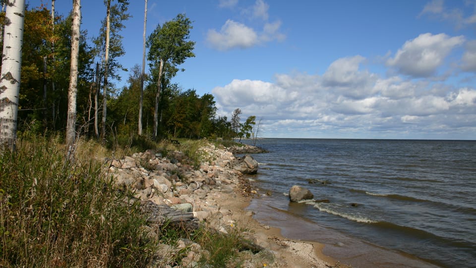
The challenges didn’t stop there. After the original government survey in the 1800s, the U.S. and Canada built a dam on the Rainy River, raising water levels and flooding many shoreline corners. Some markers were now underwater, their locations preserved only in old notes.
Widseth’s surveying team also uncovered a pattern of errors from the 1980s and 1990s. When previous surveyors couldn’t find a monument in some areas, they used road centerlines and intersections as substitutes, a common practice elsewhere but not accurate here. Once they began excavating, they found some corners that were 15 to 20 feet off from their true positions.
In the end, the project was about more than finding buried or lost markers. It was about reconnecting the present to a past that had slowly disappeared beneath soil, water, and time. Each recovered corner helped redraw the true shape of the county, ensuring that what was once uncertain is now clearly, and permanently, defined.